Monsoonal surge from midweek through mid-weekend followed by drying
Monday, June 27, 2016
The current hot and dry conditions will transition to a wetter flow by midweek as this season’s first monsoonal moisture surge encroaches over the Steamboat Springs area.
A wave that had been moving from the east in the tropical flow across central Mexico this past week will be absorbed in the southwest flow on the western periphery of the Great Basin ridge tomorrow. After another hot day on Tuesday, with only a slight chance of afternoon storms that will bring more wind than rain if they do occur, humidity will noticeably increase on Wednesday as that wave to our west crosses Utah.
Afternoon showers will become more likely by Wednesday, with some lingering overnight in the moist environment. A cool front from energy traveling around a branch of the Polar Vortex near Hudson Bay will graze northern Colorado and be the focus of more rainfall for Thursday as it interacts with the still moist atmosphere.
Additional waves from the south will keep humidity high and the chance of afternoon storms around for Friday, Saturday and possibly Sunday. Interestingly, a still strong westerly jet stream moving across the Pacific will move another storm to the Northwest coast by Sunday. While models have this storm staying mostly north of us on Monday, drier air filters into our region as soon as later Sunday.
Furthermore, the strong westerly winds from this storm will bring breezy to windy conditions to our area around the Fourth of July and cut off the flow of monsoon moisture from the south through at least midweek. There may also be a cool front, currently timed for Tuesday, that will knock temperatures back to normal on that day.
Weekend cooling followed by more hot weather
Wednesday, June 22, 2016
A strong summer storm currently spinning in the Gulf of Alaska as of Wednesday afternoon, courtesy of a seasonally strong Polar Vortex still dumping cool air around both US coasts, will nudge the ridge of high pressure over our area eastward, allowing a surge of moisture from the south to be drawn northward along the western periphery of the ridge. We should have more extensive cloud cover and our best chance for wetting rains by Thursday afternoon.
By Friday, the Pacific Northwest storm will have has crossed the coast, and the increased westerly winds will cut off the southern moisture feed into our area, though there will still be a chance of afternoon storms. Models move a relatively strong but dry cool front through the area Saturday morning, bringing dry breezy to windy conditions and cooler temperatures for the weekend, especially for Saturday.
Temperatures will rebound to above normal by Monday and last until midweek as the ridge of high pressure rebuilds over the west as cool air from the persistent Polar Vortex keeps troughs of low pressure over the Gulf of Alaska and the East Coast.
By midweek, yet another strong Pacific Northwest storm will again nudge the western ridge eastward, allowing moisture from the south to once again travel over our area. This moisture feed may be more persistent than the current brief surge we are currently seeing, with longer range models keeping what appears to be the beginnings of our monsoon around for the following week.
Monsoonal flow refers to the seasonal reversal of the winds, and in our case this refers to the influx of moisture as southerly winds pick up moisture originally from the Gulf of Mexico that has moved westward across Mexico and moves it over our area.
Hot weather with some moisture for Thursday and Friday before weekend cooling
Monday, June 20, 2016
The couple of weak waves yesterday and today did little more than keep morning temperatures cool as the strong summer sun quickly modified the airmass. Tuesday should be even warmer than today as the western ridge expands directly over the Rocky Mountains.
Another storm passing well to our north along the Canadian border late Tuesday may shave a few degrees off of Wednesday’s high temperatures as the western ridge flattens, and allows some moisture from the south to move northward across Colorado and produce some afternoon clouds. There may possibly be some high-based and relatively dry mountain storms.
Another stronger storm forecast to be off the Pacific Northwest coast by Thursday will nudge the ridge eastward, allowing a stronger surge of moisture from the south to be drawn northward along the western periphery of the ridge. We should have more extensive cloud cover and our best chance for afternoon storms by Thursday afternoon.
By Friday, the Pacific Northwest storm will have has crossed the coast, and the increased westerly winds will cut off the southern moisture feed into our area, though there will still be a chance of afternoon storms. Models move a relatively strong but dry cool front through the area Saturday morning, bringing dry breezy conditions and cooler temperatures for the weekend.
Some sunsets from the first half of June
Saturday, June 18, 2016
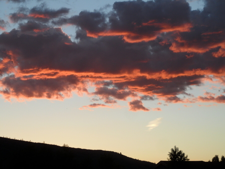 A few sunset pictures taken from my deck during the last couple of weeks. This photo was snapped on 5 June.
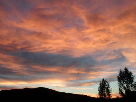 This was taken on 9 June.
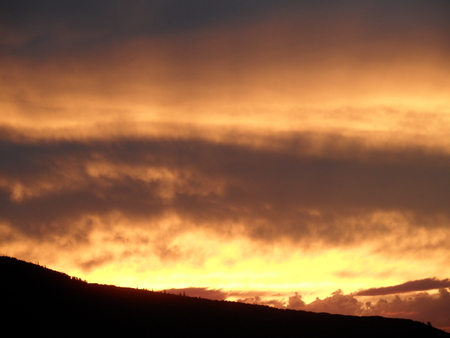 This was taken on 11 June.
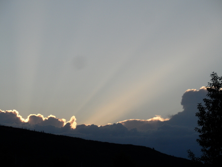 And this was taken the next evening on 12 June.
Slight cooling for Sunday, Monday followed by hot temperatures and monsoonal flow
Friday, June 17, 2016
After another couple of hot and dry days for Friday and Saturday, a wave passing to our north on Sunday will moderate temperatures a bit as a couple of weak cool fronts pass through the area on Sunday and Monday. There may also be a slight chance of afternoon storms each day as the cool fronts destabilize the atmosphere for the first time in a week.
The storm to our north will amplify into a deep eastern trough through the week as still cold air from Canada is drawn southward into the eastern third of the country. Additionally, another Pacific storm will approach the West Coast early in the week, and a strong western ridge will rebuild over the Great Basin early in the week before being nudged eastward by the slowly advancing Pacific storm.
Hot temperatures will return by Tuesday afternoon, and as the ridge slowly moves eastward the southerly flow around the west side of the ridge will allow the southwest US monsoon to make its first appearance of this summer season.
Monsoonal flow refers to the seasonal reversal of the winds, and in our case this refers to the influx of moisture as southerly winds pick up moisture originally from the Gulf of Mexico that has moved westward across Mexico and moves it over our area.
Only a slight chance of afternoon storms are expected for Tuesday and Wednesday as temperatures soar to their warmest reading of the season under the building ridge. The monsoon becomes established enough by Thursday to bring a greater chance of clouds and afternoon storms that may last through the weekend.


