Dry weather follows chance of light snow tonight
Sunday, November 10, 2019
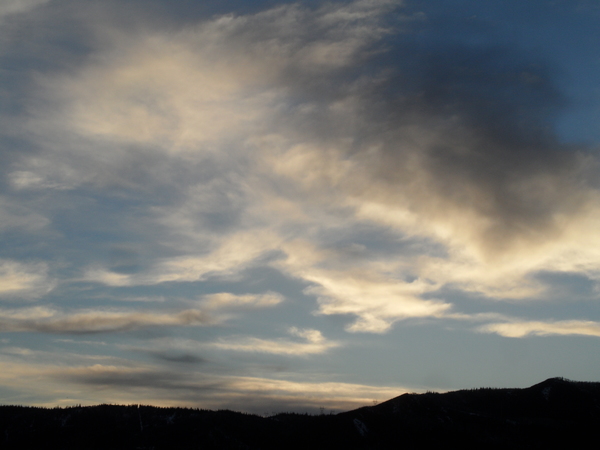
After another sunny bluebird morning in Steamboat Springs, clouds have overspread northern Colorado in advance of a grazing storm that will be mainly felt in areas to our east. There will be a chance of some light snow showers tonight and early Veterans Day morning, especially at the higher elevations before dry weather is forecast for the rest of the upcoming week.
A persistent ridge of high pressure over the West Coast has been deflecting incoming Pacific weather systems around our area for the last week. However, the storm currently on our doorstep has managed a far-enough-west trajectory to bring the chance of some snow showers tonight and early Monday morning, especially at the higher elevations.
While the main effects of the storm will be felt east of our area, including the Front Range, we will see high temperatures on Monday five to ten degrees below our average of 46 F, even with some afternoon sun. A chilly start to Tuesday morning follows as the clear skies and light winds allow temperatures to drop ten to 15 degrees below our average of 19 F.
Sunny skies will be the rule through the work, with temperatures around average on Tuesday bouncing back to five to ten degrees above average for the rest of the work week, despite another grazing storm later Wednesday that looks to have very little effect on our weather.
A strong storm is forecast to develop in the Gulf of Alaska midweek, and weather forecast models agree that this may be the beginning of a hemispheric pattern change that will deamplify or remove the West Coast ridge of high pressure and allow Pacific storms to propagate inland.
Forecasts are always uncertain during major pattern changes such as this, but currently the storm is likely to split to some degree as it crosses the West Coast early in the weekend (as forecast by the American GFS last week). There is disagreement on how much energy is partitioned in the northern and southern parts of the split, though the weather will likely remain dry over the weekend with this initial storm. That does look to change soon after the following work week starts as additional storms are forecast to move inland and possibly pass near or over our area.
Quiet weather for the upcoming week
Thursday, November 7, 2019
The sunny skies and seasonably warm temperatures observed in Steamboat Springs this week will continue for the upcoming week, save for a couple of grazing storms that will bring clouds and cooler temperatures for Monday and later Wednesday.
The benign weather is due to a large and stable ridge of high pressure over the West Coast which extends across Alaska and into Siberia. An incoming Pacific storm will travel through the West Coast ridge this weekend and mix with some cold air from the Canadian Plains as it sinks toward the Midwest, grazing our area late Sunday or early Monday and briefly interrupting the current gorgeous late-fall weather.
The Rocky Mountains will divert moisture and most of the cold air to the Front Range and areas east, but we will see some clouds and a cool down on Veterans Day from the recent five to ten degrees above our average of 47 F to five to ten degrees below. There will also be a small chance of some high elevations snow showers.
While the sun should return on Tuesday, temperatures will increase toward average even as the morning starts chilly.
Another grazing storm is forecast for later Wednesday, and though it won’t be as cold, the storm track may be slightly further to the west. Again, there will be increasing clouds and only a slight chance of snow showers at the higher elevations before the sun returns for more dry and seasonably warm weather for the rest of the work week and headed into the weekend. So the Steamboat Ski Resort’s just-announced and earliest ever Opening Day on that Friday is currently forecast to be a nice one.
Longer-term models agree on another storm crossing the West Coast around the following weekend, but disagree on the storm track, with the more consistent ECMWF forecasting another grazing storm and the more mercurial-this-season American GFS forecasting some type of splitting storm that may bring some weather into the West.
Dry and pleasant weather through the upcoming week
Monday, November 4, 2019
After a cool front grazed Steamboat Springs this Monday morning and brought some clouds, the sun has returned with a 2:30 pm temperature of 46 F, only two degrees below our average. Other than another grazing cool front for late Wednesday or early Thursday, seasonably warm temperatures around five to as much as ten degrees above average are expected through Saturday, after which some light precipitation may return to our area for the end of the weekend.
A ridge of high pressure over the West Coast has directed the unseasonably cold air from last week into the upper Midwest and Northeast, allowing for warming temperatures and light northwesterly winds over our area. This pattern will be persistent through this week and likely the next week as well, mostly deflecting the waves of Pacific energy and moisture riding over the top of the ridge to our east.
A couple of waves will drag cool fronts near north-central Colorado for Thursday and Sunday, cooling temperatures back several degrees below average. While the Thursday wave looks dry, there is a good chance of some light snow showers for Sunday into Monday. Otherwise, expect lots of sun and very pleasant weather, with high temperatures around five to almost ten degrees above average.
This pattern looks to persist into at least the middle of the following week, though long-range weather forecast models do indicate a strengthening Pacific jet stream that will eventually carry storms closer to our area as that workweek progresses.


